

T-Rex
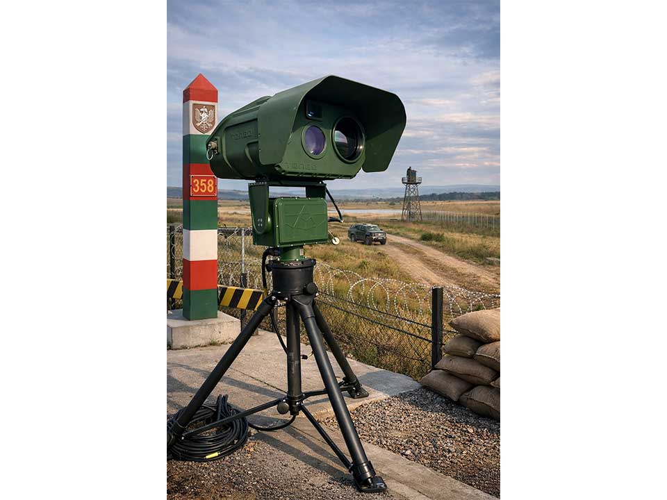
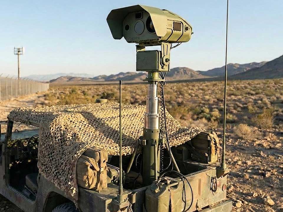
The T-Rex is a state-of-the-art, multi-spectral electro-optical system engineered by Tonbo Imaging to deliver unmatched situational awareness, target acquisition, and surveillance capability across operational
theatres. Whether mounted on land vehicles, naval platforms, or fixed installations, the T-Rex is built for real-time decision superiority in complex and contested environments.
At its core, the T-Rex integrates cooled MWIR thermal imaging, low-light HD visible, SWIR, and NIR sensors, providing simultaneous multi-spectral imaging and real-time fusion. The system excels in day/night operations, seeing through smoke, haze, and camouflage to deliver crystal-clear imagery in all conditions.
Equipped with an eyesafe laser rangefinder, GPS, digital compass, and auto video tracking, the system enables precise detection, identification, and geolocation of both static and moving targets. The advanced slew-to-cue capability allows automatic orientation to external radar or sensor inputs, accelerating threat engagement cycles.
The T-Rex is a fully integrated, single-LRU (Line Replaceable Unit) system, significantly reducing setup time, eliminating field alignment, and simplifying logistics in forward deployments.
Key Features:
- Multi-Spectral Imaging: MWIR, SWIR, NIR, and HD visible with real-time fusion and independent or fused display modes.
- Laser Range Finder: Eyesafe, long-range, high-accuracy distance measurement.
- Auto Video Target Tracking: Intelligent multi-sensor tracking of dynamic or static threats.
- Slew-to-Cue: Responds to radar or external cues for rapid orientation to points of interest.
- Panoramic Stitching: Generates wide-area stitched views in thermal, EO, or fused formats.
- Integrated GPS and Digital Compass: Enables accurate geo-referencing and directional targeting.
- Single-LRUArchitecture: Field-ready, no need for sensor re-alignment; fast and intuitive deployment.
Operational Integration:
- C2 Software Compatibility: Seamless integration with Tonbo’s Command & Control (C2) software suite featuring GIS-based mission management, target annotation, map overlays, and sensor geolocation.
- Multi-Screen Display System: Compatible with Tonbo’s tactical display stations supporting multi-sensor feeds, fused video, and multi-view tracking for real-time battlefield visualization and operator efficiency.
Power & Deployment Flexibility:
- Multi-Power Support: Operates on AC power, Li-ion battery packs, or fuel cells—ideal for unattended or long-duration deployments in remote or silent operating conditions.
- Flexible Mounting Options: Deployable on tripods, high masts (coastal/border), and telescopic vehicle
masts for static or mobile use cases.
Battlefield-Ready:
- MIL-STD-Qualified Enclosure: Rugged, weatherproof, and shock-resistant for harsh environments.
- Modular & Scalable: Integrates with C4ISR networks, counter-UAV platforms, and fire control systems.
Primary Applications:
- Counter-UAV Operations: Detect, track, and identify drones; integrate with neutralization systems.
- Artillery Fire Correction: Observe and range impact points for precision engagement.
- Persistent Surveillance: Monitor borders, high-value targets, and threat zones with realtime fused imagery and GIS overlay.
